Commentary
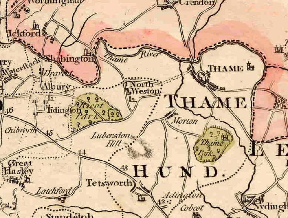
This map showing Thame is taken from a map of Oxfordshire made by Cary in 1805.
Note that there appears to be no road from Moreton into Thame. The ancient track across the fields has not been upgraded, and the present vehicle access road to Moreton off the A329 has not yet been constructed.
The dotted lines probably indicate trackways for people and livestock, rather than made-up roads. Note that there is no made-up road between North Weston and Albury.
The numbers on the road out of Tetsworth are milestones, being the number of miles from London, and some of them are still there.