Commentary
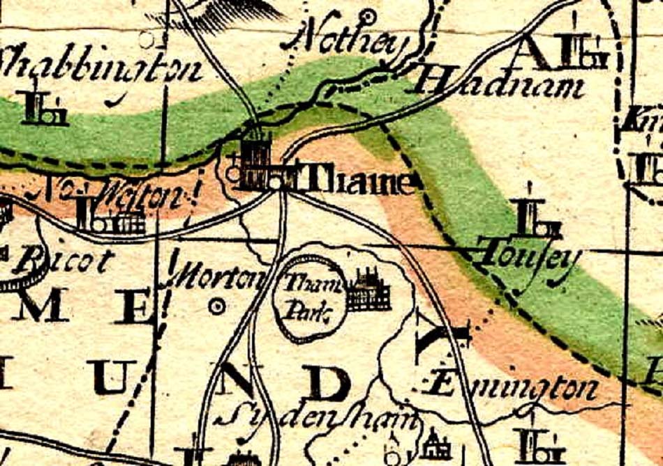
This map showing Thame is taken from a map of Oxfordshire made by Cole in 1715.
There is no internal detail for Thame, but the roads are clearly shown.
This map also shows the Oxfordshire Buckinghamshire border in striking brown and green.
We can see the Long Crendon Road, and going clockwise from there, the Haddenham road, the Emmington/Chinnor road, the Moreton road and the North Weston road.
Clearly missing are Thame Park Road and the road to Milton Common, both of which where constructed later in the eighteenth century as new turnpike roads.
The state of these roads in 1715 should not be thought of as anything approaching even a B road today. They were wide enough only for a single carriage, and very often little more than a dirt track. This is evident from what remains of the Thame to Tetsworth via Moreton road today, which fell out of use and was never upgraded.