Commentary
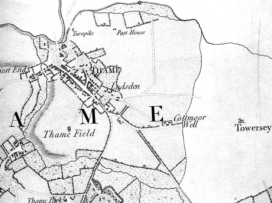
This map showing Thame is taken from a map of Oxfordshire made by Davis in 1797.
We can see the burgage plots along the southern part of the Lower High Street at Thame, and we can also see the ancient town enclosures.
The windmill we have seen on Barley Hill in earlier maps is not shown on this map, but a new windmill at the end of what is now Windmill Road is shown.
At the top of the map, we see Thame's Pest House. This was an isolated residence for unfortunate souls with contagious diseases.
To the left of the Pest House we see the Aylesbury Road Turnpike, where tolls were paid by travellers to Aylesbury.