Commentary
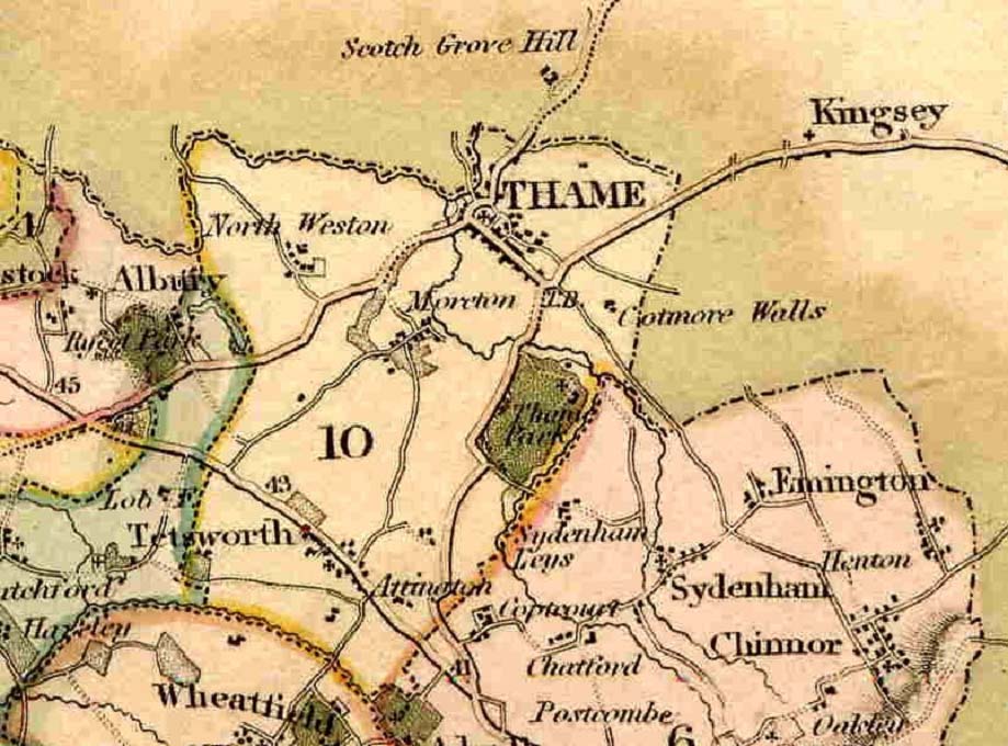
This map showing Thame is taken from a map of Oxfordshire made by C and J Greenwood in 1820.
The road from Moreton to what is now the A329 appears for the first time here, indicating perhaps the need for a better quality road to serve the small community at Moreton, given that the ancient trackway into Thame was never upgraded.
Note that the present A418 between North Weston and Albury has not yet been built.
The Thame to Kingsey road appears here in some prominence for the first time. This in not the current Thame to Princes Risborough road, but the older road that begins in Park Street as Queens Road and today continues in more or less a straight line across the Thame Show ground.
Kings Road and Towersey Road can be seen joining on to Queens Road in this map, as they do today.
(The present Princes Risborough road and its continuation as East Street were built around ten years after this map was made.)