Commentary
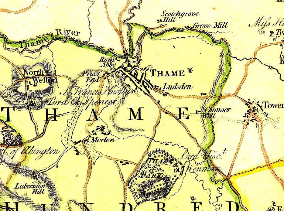
This map showing Thame is taken from a map of Oxfordshire made by Jeffreys in 1767.
The degree of detail on this map is of a different order from the previous maps by Kitchen, Overton and Morden. It is a rich source of information.
The Aylesbury to Shillingford Turnpike Road was opened a short time after this map was made. The course of that road ran from Thame, past the entrance to Rycote Park and over Milton Common. (It is today the A329).
This map appears to show this road in a state of partial construction. It has been constructed over the Earl of Abingdon's land, running up from Milton Common, but it looks as if it has not yet been built across Priestend Common, which is clearly marked on the map as the property of Sir Francis Knollys and Lord Charles Spencer.
Thame Park Road has however been constructed by 1767. This formed part of the Thame to Postcombe Turnpike opened in 1785.
The ruined abbey shown next to Priestend indicates the state of Thame's Prebendal House in 1767.
The windmill shown on earlier maps, where it was called Thame Mill, is visible here, and appears to be located on Barley Hill.