Commentary
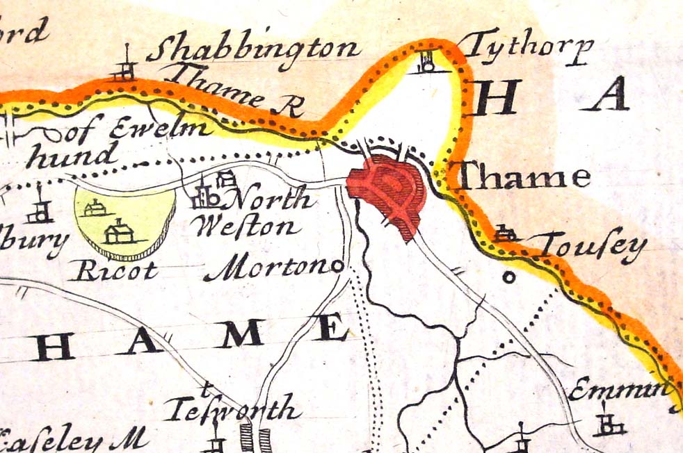
This map showing Thame is taken from a map of Oxfordshire made by Robert Morden in 1695.
There is much more information about the local roads on this map than has appeared on any map before now.
We also see for the first time something of the internal structure of Thame itself. The three bridges or fords shown on the earliest map of 1574 can be seen, and we can identify them as the present Oxford Road crossing over Cuttle Brook, the Long Crendon Bridge and the bridges at Scotsgrove.
The road from Tetsworth to Thame via Moreton is clearly shown, as is the road from Thame to Albury via North Weston. We can also make out the road from Thame towards Chinnor, passing by Emmington.