Commentary
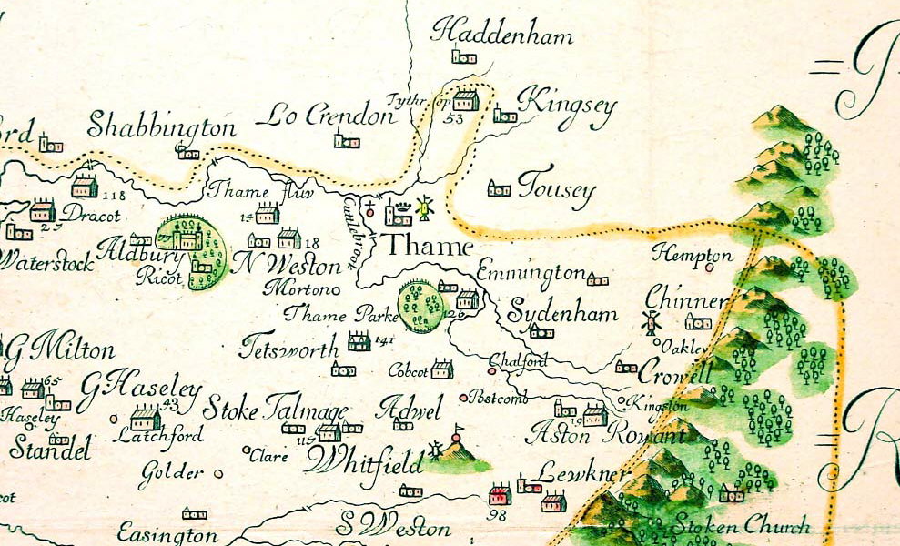
This map showing Thame is taken from a map of Oxfordshire made by Plot in 1676.
The spelling of place names, including Thame, is a lot closer to the modern spelling than the earlier maps.
Plot has corrected the earlier mistake made by William Hole, and has given Thame Park and Rycote Park their true names. He has also named Cuttle Brook.
At Thame Park, the house and chapel are shown. The house is clearly substantial, although it did not get its grand Palladian frontage until 1745.
At Rycote the chapel is also shown, as is Rycote Palace, which is represented differently from the other large houses, by a symbol that appears to reflect the actual frontage of the palace.
North Weston appears for the first time, and appears to have two substantial houses and a chapel.
Several other settlements which we know to be older than the earliest of these maps, such as Moreton, also appear for first time, due to the greater level of detail shown by Plot. Despite this, no roads are shown.