Commentary
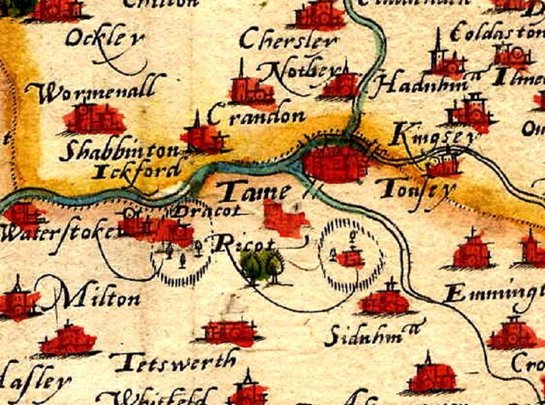
This is the earliest map showing Thame, taken from a survey of Oxfordshire made by Christopher Saxton in 1574.
Note that Rycote Park and Thame Park are shown, although Thame Park is not named.
There are no roads shown on this map, although three bridges are shown. One over the river Thame towards Long Crendon, one over Cuttle Brook in the direction of Rycote, and one over the second major tributary of the river Thame, towards Haddenham.