Commentary
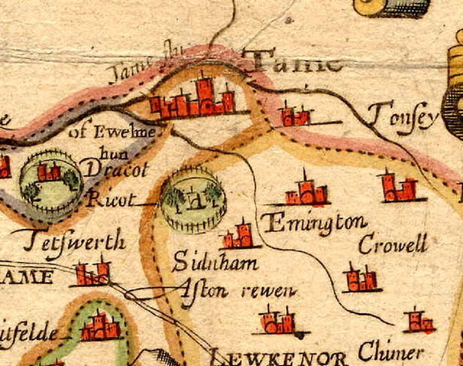
This map showing Thame is taken from a map of Oxfordshire made by John Speed (1552 - 1629) in 1611.
It is largely based on the Saxton map of 1574, or rather on the engraving made by William Hole in 1610, as Hole's mistake in naming Rycote Park and Thame Park is reproduced by Speed.
Significant additions made by Speed are the hundred boundaries and the London to Oxford road going through Tetsworth.
The three bridges shown by Saxton are still evident, and the road over the southern bridge, leading towards Rycote, is shown as forming the boundary between the Thame Hundred and a part of the Ewelme Hundred.
The road from Tetsworth to Oxford can be seen from the full Oxfordshire version of this map to go via Great Milton and Cuddesdon.